info@3deepmedia.com
+44 (0)1326 330 036
Using both aerial (drone) technologies as well as ground based and underwater photogrammetry techniques, we generate accurate 3D models and interactive tours. From surveying historic buildings, geological sites, shipwrecks through to interactive aerial maps for leisure and tourism. Based in Cornwall, we serve clients across the UK.

Accurate
Accuracy down to less than 1 cm can be achieved.
Accessible
Viewable in an interactive format across all devices.
VR Ready
Models are compatible and viewable with VR headsets.
UAV/Drones
Latest drone technology with 20MP still RAW image data.
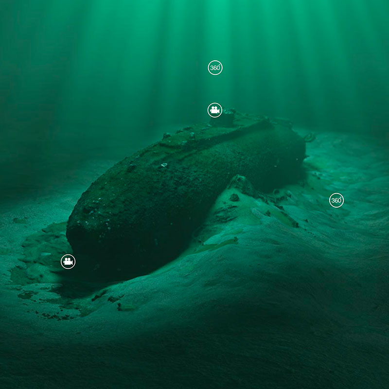
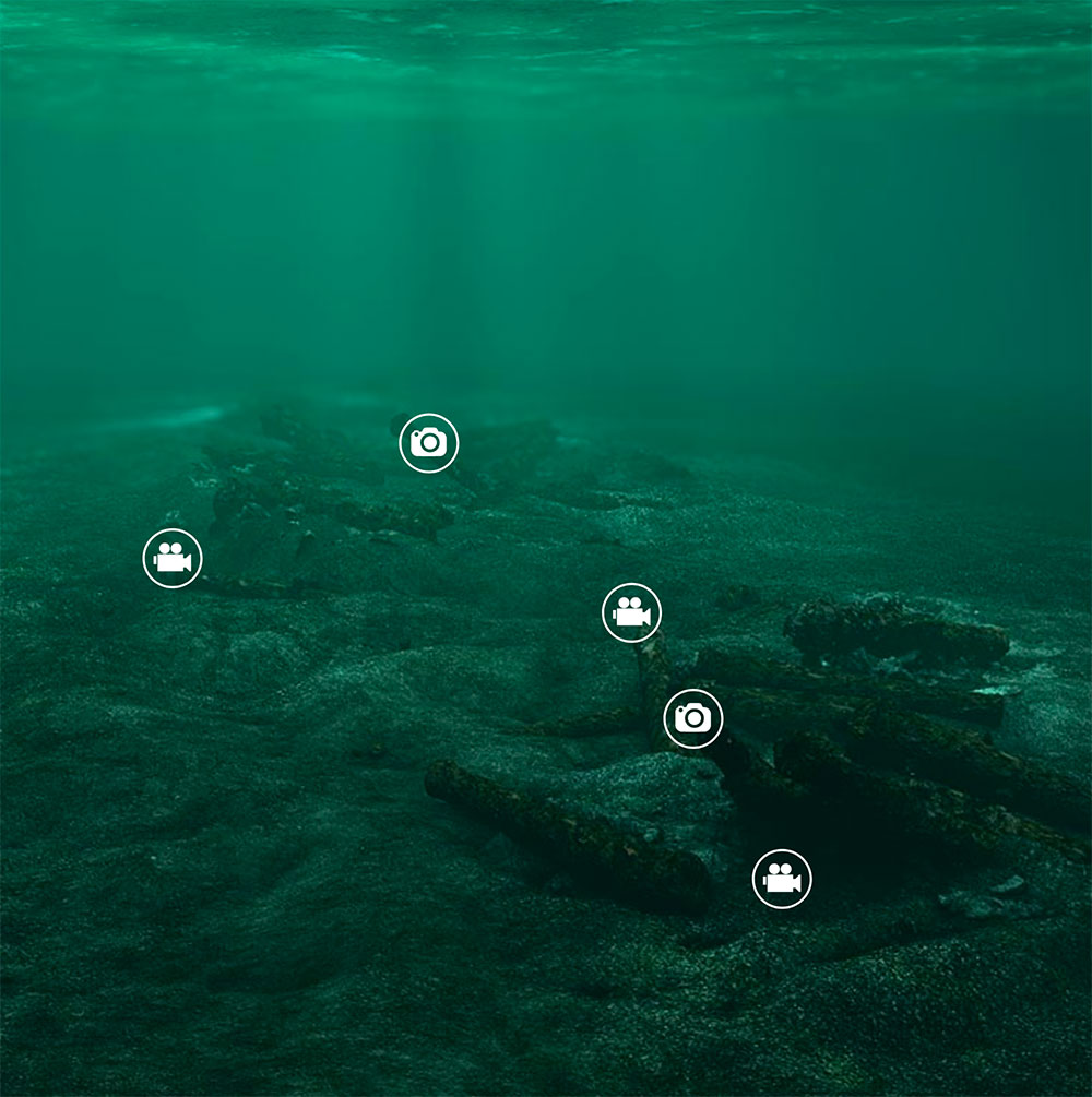
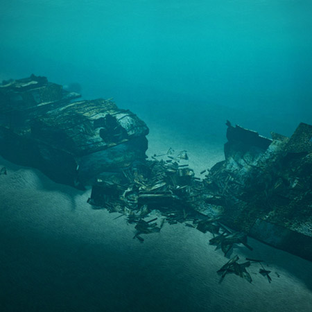
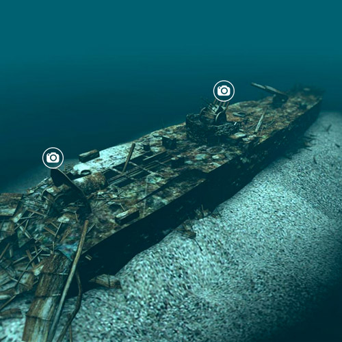
3D modelling of shipwrecks and other underwater sites
For the past five years, 3deep Media have led the field of modelling shipwrecks and other underwater sites in 3D. We have skills required for the digital 3D modelling itself, but more importantly the experience and knowledge of ship construction and wreck decomposition. Since the company was founded we have worked on projects across the world, working for some of the top archaeological organisations including NOAA and the Nautical Archaeological Society.
Our work has been praised not just for the stunning visuals we create, but also its accuracy and quality as an archaeological resource.
3D Photogrammetry Surveys and Visualisations
Using the latest aerial (drone) technologies we specialise in generating accurate 3D models and interactive tours from aerial data, from surveying historic buildings and geological sites, through to interactive aerial maps for leisure and tourism. Based in Cornwall, we serve clients across the UK.
EXAMPLES OF PREVIOUS 3D PROJECTS
View some of the previous 3D modelling and visualisation projects we have worked on from around the UK and further a field.


Documenting Heritage and Archaeology
Aerial systems are a cost effective and accurate way of documenting and surveying historical and archaeological sites. 3D models generated from the aerial data can be used for many different types of analysis, or further developed into 3D tours showing what sites looked like at different periods in time (like our Wheal Prosper example above).

Geological Surveys
3D aerial mapping provides much faster and detailed methods of carrying out geological / landscape surveys. It’s also a safer alternative for locations that are difficult or dangerous to reach, such a cliff erosion inspections. An automated remote system also means that the data can be analysed again in the future from the same survey points.

Leisure & Tourism
For outdoor leisure businesses, such as golf courses showing customers what you have to offer is vital. Interactive 3D tours of individual elements of your site, or a map of the whole location is a great way to encourage visitors and show key information about your services. Combined with photos and videos, customers get a useful and memorable experience prior to and during their visit.

© All content copyright 3deep Media Ltd 2018.